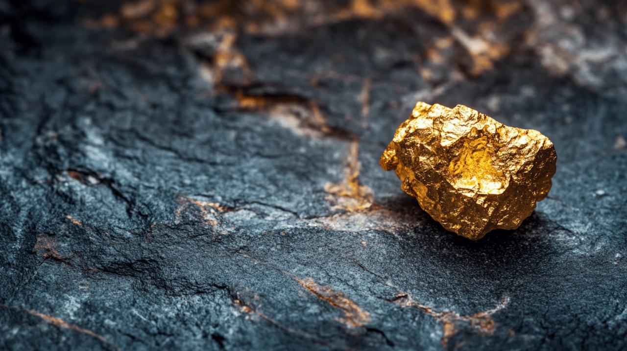
The allure of raw gold has captivated humanity for millennia, driving explorers and prospectors to the farthest reaches of the globe in search of its gleaming promise. Unlike refined bullion, the discovery of raw gold represents an encounter with nature's unfiltered bounty, a moment where geological forces spanning millions of years converge in tangible form. Understanding where to find such treasures requires more than luck; it demands a keen appreciation of the earth's underlying structures, the tell-tale signs that nature leaves upon the landscape, and a working knowledge of the processes that concentrate this precious metal in accessible deposits. From the windswept highlands of Scotland to the arid expanses of Nevada, gold-bearing territories share distinctive characteristics that, once recognised, transform seemingly ordinary terrain into a map of potential riches.
Understanding the Geological Foundations of Gold Deposits
Primary rock formations and mineralisation processes
Gold does not simply appear at random across the landscape; its presence is intimately tied to specific geological events and rock types. Primary gold deposits, often referred to as lode or hard rock deposits, form deep within the earth's crust through processes involving immense heat and pressure. Igneous and metamorphic rocks, particularly those that have undergone significant tectonic activity, serve as the primary hosts for gold mineralisation. Granitic intrusions, which are masses of molten rock that cooled slowly beneath the surface, frequently carry gold-bearing fluids that infiltrate surrounding rocks, creating veins rich in precious metals. These veins, composed largely of quartz and other silicate minerals, act as conduits through which mineralised fluids travel, depositing gold along fractures and faults. The concentration of gold within these structures can vary dramatically, but where conditions align favourably, the result can be substantial accumulations worthy of extraction.
The mineralisation process itself is a complex interplay of chemistry and geology. As superheated fluids, often originating from magma chambers, rise through the crust, they carry dissolved metals including gold. When these fluids encounter cooler temperatures or chemical changes in the surrounding rock, the metals precipitate out of solution, forming solid deposits. This process is most effective in areas where rock contact zones and faults provide pathways and traps for the migrating fluids. Fault zones, in particular, are critical as they create fractures that allow fluids to penetrate deeply and deposit their metallic cargo over time. Recognising productive rock types in the field, such as greenschist or zones of intense alteration, can guide prospectors towards areas where gold is more likely to be concentrated.
Identifying ancient volcanic activity and hydrothermal systems
Volcanic activity, both ancient and relatively recent, plays a pivotal role in the formation of many gold deposits. Hydrothermal systems associated with volcanic regions are among the most prolific sources of gold on the planet. These systems develop when magma heats groundwater, creating a circulation of mineral-rich fluids through the surrounding rocks. As these fluids ascend towards the surface, they can deposit gold and other valuable minerals in veins and disseminated deposits. The presence of volcanic rock formations, such as basalt or rhyolite, often signals the possibility of underlying hydrothermal activity that may have concentrated gold in economic quantities.
Iron staining and gossans, which are rust-coloured surface expressions of weathered sulphide minerals, serve as vital indicators of these hydrothermal processes. When sulphide minerals oxidise at the surface, they produce distinctive ochre and reddish hues that can be visible from considerable distances. These stains often overlie deeper ore bodies, making them invaluable markers for prospectors. Additionally, quartz vein outcrops and vein matter accumulations are classic signs of hydrothermal activity. Quartz veins, which can range from thin streaks to massive structures several metres wide, are the most common host rock for lode gold. Observing the density, orientation, and extent of these veins provides insight into the intensity of the mineralising event and the likelihood of discovering significant gold deposits. Colour changes in the rock, often accompanied by alteration minerals such as sericite or clay, further confirm the presence of hydrothermal fluids that may have transported and deposited gold.
Surface indicators and landscape features that signal gold presence
Recognising quartz veins and associated mineral outcrops
Walking across a hillside or along a riverbank, the trained eye can discern subtle clues that reveal the presence of gold beneath the soil. Quartz veins, with their milky white or glassy appearance, stand out against the darker tones of surrounding rock. These veins often contain small amounts of gold, and where they have been eroded by weathering, fragments of quartz can accumulate in the soil and streambeds, pointing back to the source. Extensions of known mineral or placer areas offer additional guidance, as gold deposits tend to occur in clusters or along geological trends that can span considerable distances. If gold has been found in a particular region, it is reasonable to expect that similar geologic areas nearby may also harbour deposits.
Desert pavement with quartz vein matter is another intriguing indicator. In arid environments, wind and water erosion remove finer sediments, leaving behind a surface layer of stones and pebbles. When this pavement contains fragments of quartz or other minerals associated with gold, it suggests that gold-bearing veins may lie beneath or nearby. Similarly, black soil by the river, often enriched with organic material and heavy minerals, can signal the presence of placer deposits where gold has been concentrated by the action of flowing water. These visual cues, when combined with a knowledge of local geology, enable prospectors to narrow their search and focus efforts on the most promising ground.
Reading the Terrain: Creek Beds, Alluvial Deposits, and Erosion Patterns
The movement of water over geological timescales is a powerful force in concentrating gold into accessible placer deposits. Creek beds, riverbeds, and alluvial plains are prime locations for discovering raw gold, as the metal's high density causes it to settle in low-energy zones where lighter sediments are washed away. Understanding the correct topography is essential for identifying these zones. Gold tends to accumulate on the inside bends of rivers, behind large boulders, in cracks and crevices of bedrock, and in areas where the flow of water slows, allowing heavier materials to drop out of suspension. These placer deposits can range from fine flour gold, barely visible to the naked eye, to substantial nuggets that represent the culmination of countless years of erosion and transport.
Erosion patterns also provide valuable information about the underlying geology. Areas where ancient rivers once flowed, now perhaps elevated or buried, can still contain rich placer deposits. Terraces along hillsides, remnants of old stream channels, and buried gravels all offer opportunities for discovery. In the United Kingdom, regions such as the Lake District, Strath of Kildonan, and the Northern Pennines have produced gold through both panning and small-scale mining operations. The Reunion Nugget, discovered in Scotland and valued at around eighty thousand pounds in 2019, exemplifies the potential of these placer environments. Similarly, a significant nugget found off Anglesey in North Wales in 2012 was estimated to be worth fifty thousand pounds, while the Douglas Nugget, recovered from a Scottish riverbed, carried a similar valuation. These finds underscore the importance of understanding how erosion and sediment transport concentrate gold in specific locations, making them accessible to those willing to explore the terrain with patience and insight.
Exploring historic gold-bearing regions and their distinctive characteristics
Established gold fields and their geological signatures
Historic gold-bearing regions offer a wealth of knowledge for modern prospectors, as the geological conditions that produced gold in the past remain relevant today. In the United Kingdom, areas such as Dumfries and Galloway, particularly around Mennock Water and Wanlock Water, have a long association with gold. The Northern Pennines, stretching across northern England, also contain mineralised zones where gold can be found in association with lead and other base metals. Cornwall, especially around Camborne, has a rich mining heritage that includes gold, and the Hopetoun Estate near Edinburgh has yielded finds in recent years. These regions share common geological traits, including the presence of ancient volcanic rocks, extensive faulting, and evidence of hydrothermal activity. The Clogau Gold Mine in Wales is perhaps the most famous British gold source, renowned for producing the metal used in royal wedding rings. Though the mine is no longer in active production, its legacy highlights the geological potential of the Welsh mountains.
Scotland's Tyndrum area has seen modern interest in gold mining, with exploration and development projects examining the feasibility of extracting gold from the region's ore bodies. These activities underscore the enduring appeal of historic gold fields, where decades or even centuries of exploration have mapped the geology in detail, providing a foundation for continued discovery. Understanding the distinctive characteristics of these regions, from the types of rocks present to the patterns of mineralisation, allows prospectors to apply similar criteria when evaluating new or less explored territories. The geological signatures of established gold fields serve as templates, guiding the search for similar conditions elsewhere.
Comparative analysis of gold-rich territories worldwide
While the United Kingdom offers intriguing opportunities for gold discovery, the world's major gold-producing regions provide compelling case studies in the diversity of gold deposits. The Witwatersrand basin in South Africa, which holds over forty per cent of the world's gold reserves, is a prime example of a conglomerate-hosted deposit, where gold is found in ancient sedimentary rocks that have been subjected to deep burial and metamorphism. Since 1886, more than 1.5 billion ounces of gold have been extracted from this region, making it the most productive gold field in history. In contrast, the Carlin Trend in Nevada represents a different type of deposit, where gold is disseminated in fine particles throughout limestone and other sedimentary rocks. Discovered in 1961, the Carlin Trend has produced over 87 million ounces of gold, demonstrating the economic importance of recognising deposits that do not conform to the classic quartz vein model.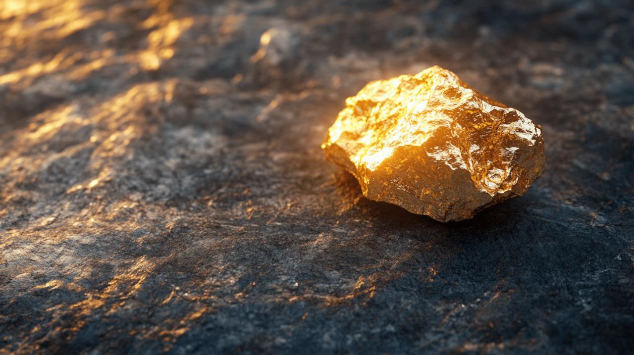
In Indonesia, the Grasberg Mine produces approximately 2.7 million ounces of gold annually, extracted from a porphyry copper-gold system associated with volcanic activity. The Muruntau Mine in Uzbekistan, yielding around two million ounces yearly, is one of the largest open-pit gold mines in the world, exploiting a disseminated deposit in altered volcanic rocks. Russia's Olimpiada Gold Mine contributes about 1.4 million ounces per year, while the Pueblo Viejo Gold Mine in the Dominican Republic produces around 1.3 million ounces annually. Each of these sites reflects unique geological conditions, yet they all share the fundamental requirement of a heat source, fluid circulation, and a mechanism for concentrating gold into mineable quantities. Historic examples, such as the California Gold Rush of 1848, which saw over 750,000 pounds of gold extracted from the Sierra Nevada, and the Klondike Gold Rush of 1896 to 1899, where approximately 1.5 million ounces were recovered from Bonanza Creek, illustrate how geological endowments have shaped human history and migration patterns.
Ancient civilisations also recognised and exploited gold deposits, with the Egyptians mining the Nubian Desert around 2450 to 2600 BCE and the Romans extracting some 165,000 kilogrammes from Las Médulas in Spain. The Pactolus River in Anatolia, modern-day Turkey, was a source of alluvial gold around 700 BCE, while the Incas mined over 1,000 tons of gold across South America. These historical precedents demonstrate that the principles of gold prospecting are timeless, rooted in an understanding of geology and landscape that transcends eras and technologies. The Welcome Stranger nugget, discovered in Australia in 1869 and weighing 72 kilogrammes, remains one of the largest gold nuggets ever found, a testament to the extraordinary concentrations that natural processes can achieve. By studying these diverse examples, prospectors gain a broader perspective on the variety of geological settings that can host gold, enhancing their ability to identify promising ground wherever they may search.
Practical Techniques for Locating and Assessing Gold-Bearing Ground
Field Methods for Testing Mineral Concentrations and Soil Samples
Once promising ground has been identified through geological reconnaissance, practical field techniques enable prospectors to assess the actual presence and concentration of gold. Panning remains one of the most effective and time-honoured methods for testing placer deposits. By carefully washing sediment in a pan, the heavier gold particles settle to the bottom, allowing even minute quantities to be observed. This simple yet reliable technique can quickly confirm whether a particular creek bed or alluvial deposit warrants further investigation. Sampling soil and sediment at regular intervals along a watercourse can help trace gold back to its source, as concentrations typically increase as one approaches the lode from which the placer material was derived.
In the United Kingdom, gold panning is legal provided that the landowner's permission has been obtained and that no harm is done to the environment. It is important to note that any gold found generally belongs to the Crown Estate, reflecting longstanding legal traditions. Despite these restrictions, the activity remains popular among hobbyists and serious prospectors alike, offering a tangible connection to the earth's geological history. Testing soil samples for colour changes and the presence of associated minerals, such as pyrite or magnetite, can provide additional clues about the likelihood of gold being present. Black sands, which are concentrations of heavy minerals, often accompany gold in placer deposits and serve as a positive indicator when found in abundance.
Utilising modern technology and traditional prospecting knowledge
Modern technology has greatly enhanced the ability to locate and evaluate gold deposits, complementing traditional prospecting methods with precision and efficiency. Metal detectors, for instance, have become indispensable tools for surface prospecting, capable of detecting gold nuggets at considerable depths beneath the soil. Advances in geophysical surveying, including magnetic and electromagnetic methods, allow prospectors to identify subsurface structures and mineralised zones without extensive excavation. Geographic information systems and satellite imagery provide powerful means of analysing landscape features, fault patterns, and the distribution of rock types over large areas, enabling prospectors to target their efforts with greater accuracy.
Despite these technological advances, the integration of traditional knowledge remains essential. Understanding the behaviour of gold in natural systems, recognising the visual and tactile cues that indicate mineralisation, and applying a keen sense of landscape interpretation cannot be replaced by instruments alone. The combination of experience and technology creates a synergy that maximises the chances of success. For instance, identifying fault zones prospecting through field mapping and then using remote sensing to trace these structures over wider areas can reveal previously overlooked opportunities. Similarly, recognising productive rock types in the field and then employing geochemical sampling to test for trace amounts of gold provides a comprehensive approach to exploration.
In regions such as Devon, Dumfries and Galloway, and Cornwall, where historical gold mining and panning have occurred, modern prospectors benefit from the accumulated wisdom of past generations. The locations of old workings, the presence of quartz vein outcrops, and the identification of iron staining and gossans all contribute to a richer understanding of where gold may be found. Companies such as Agincourt Resources, which operates the Martabe Gold Mine, demonstrate the importance of sustainability, community relations, and environmental responsibility in modern mining operations. Their commitment to these principles, reflected in annual and sustainability reports, sets a standard for how large-scale extraction can coexist with ecological stewardship and social benefit. The company's initiatives, including conservation efforts for Batang Toru and orangutan protection, free cataract surgery programmes, and the preservation of natural areas like Lubuk Larangan, illustrate that responsible mining extends beyond the extraction of resources to encompass the well-being of local communities and the environment.
Current market conditions also influence the practical aspects of prospecting and small-scale mining. Recent disruptions in the silver market, where refineries have paused processing due to high leasing costs reaching one hundred per cent, highlight the volatility and interconnectedness of precious metal markets. While this has led to adjustments in buying rates for scrap silver, gold buying rates remain unaffected, reflecting the enduring demand for this metal. Live metal prices, such as those for nine carat, eighteen carat, and twenty-two carat gold, as well as various grades of silver, platinum, and palladium, provide a real-time snapshot of market values that can inform decisions about when and where to pursue prospecting activities. Locations such as Royal Wootton Bassett in Wiltshire and Bodmin in Cornwall offer services for those looking to sell or trade their finds, connecting the act of discovery with the broader commercial market for precious metals.
In conclusion, the search for raw gold is a multifaceted endeavour that draws upon geology, history, practical skill, and modern technology. By understanding the geological foundations of gold deposits, recognising the surface indicators that signal its presence, exploring the characteristics of historic gold-bearing regions, and employing both traditional and contemporary techniques, prospectors can enhance their prospects of success. Whether in the remote highlands of Scotland, the ancient mining districts of Cornwall, or the vast gold fields of Nevada and South Africa, the principles remain consistent: gold is where geology, landscape, and persistence converge. The allure of raw gold, with its promise of discovery and connection to the earth's deep processes, continues to inspire those willing to read the land and follow its subtle clues.